Blab News
Grasshopper Fire Expands to 54,200 Acres, Threatens Highway 35 Near Mount Hood
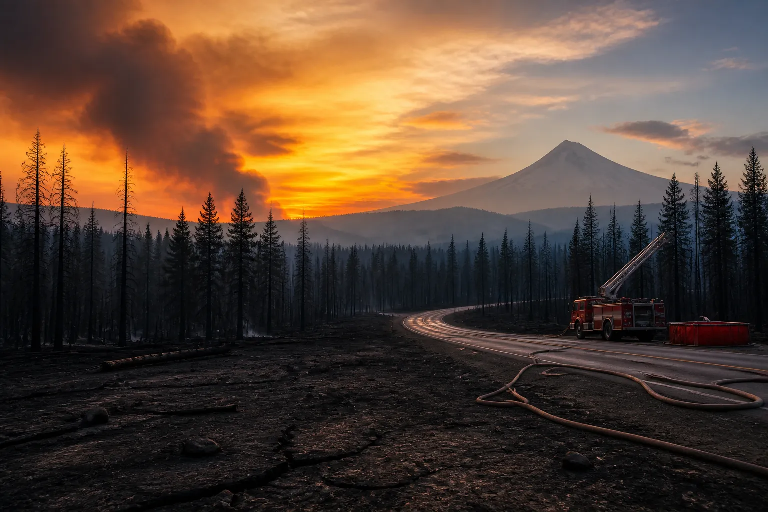
On July 23, a lightning strike ignited the Grasshopper Fire near Wamic, Oregon. By Saturday, the blaze had surged to more than 54,200 acres and was only 23 % contained, according to the incident’s operations team. The fire is pushing toward Highway 35, a key route east of Mount Hood, and has triggered a Level 3 “GO NOW” evacuation order for residents in the area.
Fire officials say the ignition was lightning‑caused and the fire is spreading across federal timber, grass, and understory vegetation in the Mount Hood National Forest. Operations Section Chief Anthony Rapoza reported that lines around the southwestern perimeter of the fire are holding and that crews are confident about containment on the eastern side. He added that the fire is “backing down toward Highway 35” in the northwest sector, describing the burn as an understory fire that is not being pushed by the wind.
The Oregon Department of Transportation has closed a segment of Highway 35 between Bennett Pass Snow Park—about four miles east of the Highway 26 intersection—and Baseline Road south of the Parkdale community. The closure protects motorists from the advancing flames and allows firefighters to build bulldozer lines and conduct strategic burns. All lanes are closed and the status may change as the fire’s behavior evolves.
In addition to roadway restrictions, a shelter for large animals has been set up at the Sherman County Fairgrounds in Moro. Fire crews are also creating defensible space around structures near the Teacup Lake area, a location that has seen increased fire activity during the 2026 season. The Oregon Air National Guard has deployed aircraft and personnel to assist with aerial suppression and logistics.
The incident is occurring under a Red Flag Warning issued by the National Weather Service, which signals hot, dry, and windy conditions that increase fire spread potential. The warning remains in effect through the weekend, complicating containment efforts. The Grasshopper Fire is one of several large blazes that have defined Oregon’s 2026 wildfire season, which has seen more than one million acres burned statewide.
Firefighters continue to monitor the fire’s perimeter and adjust tactics as weather conditions shift. The incident is under the jurisdiction of the Northwest Interagency Coordination Center, which coordinates resources from federal, state, and local agencies. Updates on containment, evacuation orders, and road closures are posted on the Oregon Department of Transportation’s TripCheck website and on the National Interagency Fire Center’s live map.
The current situation remains fluid. Fire crews are focused on preventing the blaze from crossing Highway 35 and protecting nearby communities. The Oregon Department of Transportation and the Forest Service are working to keep the highway open for emergency vehicles while maintaining public safety. The fire’s final containment percentage and the duration of the evacuation order will be determined as the weather improves and firefighting resources are deployed.
The Grasshopper Fire’s expansion underscores the challenges of managing large wildfires in the Pacific Northwest during a season of heightened fire danger. As the incident continues, authorities will provide further updates on containment progress, road status, and evacuation requirements.
Fire officials say the ignition was lightning‑caused and the fire is spreading across federal timber, grass, and understory vegetation in the Mount Hood National Forest. Operations Section Chief Anthony Rapoza reported that lines around the southwestern perimeter of the fire are holding and that crews are confident about containment on the eastern side. He added that the fire is “backing down toward Highway 35” in the northwest sector, describing the burn as an understory fire that is not being pushed by the wind.
The Oregon Department of Transportation has closed a segment of Highway 35 between Bennett Pass Snow Park—about four miles east of the Highway 26 intersection—and Baseline Road south of the Parkdale community. The closure protects motorists from the advancing flames and allows firefighters to build bulldozer lines and conduct strategic burns. All lanes are closed and the status may change as the fire’s behavior evolves.
In addition to roadway restrictions, a shelter for large animals has been set up at the Sherman County Fairgrounds in Moro. Fire crews are also creating defensible space around structures near the Teacup Lake area, a location that has seen increased fire activity during the 2026 season. The Oregon Air National Guard has deployed aircraft and personnel to assist with aerial suppression and logistics.
The incident is occurring under a Red Flag Warning issued by the National Weather Service, which signals hot, dry, and windy conditions that increase fire spread potential. The warning remains in effect through the weekend, complicating containment efforts. The Grasshopper Fire is one of several large blazes that have defined Oregon’s 2026 wildfire season, which has seen more than one million acres burned statewide.
Firefighters continue to monitor the fire’s perimeter and adjust tactics as weather conditions shift. The incident is under the jurisdiction of the Northwest Interagency Coordination Center, which coordinates resources from federal, state, and local agencies. Updates on containment, evacuation orders, and road closures are posted on the Oregon Department of Transportation’s TripCheck website and on the National Interagency Fire Center’s live map.
The current situation remains fluid. Fire crews are focused on preventing the blaze from crossing Highway 35 and protecting nearby communities. The Oregon Department of Transportation and the Forest Service are working to keep the highway open for emergency vehicles while maintaining public safety. The fire’s final containment percentage and the duration of the evacuation order will be determined as the weather improves and firefighting resources are deployed.
The Grasshopper Fire’s expansion underscores the challenges of managing large wildfires in the Pacific Northwest during a season of heightened fire danger. As the incident continues, authorities will provide further updates on containment progress, road status, and evacuation requirements.