Blab News
Indiana Faces Record-Level Rainfall and Flash Flood Threats Amid Severe Storms
The National Weather Service (NWS) has issued a severe thunderstorm warning for Dearborn, Franklin and Ripley counties in Indiana and a flash flood emergency for parts of Wayne, Fayette and Union counties. The emergency, which is the highest level of flash flood alert, was issued after 4 to 8 inches of rain fell in the region and more precipitation is expected.
The NWS notes that the West Fork of the Whitewater River at Alpine, Fayette County, is likely to experience record‑setting flooding. Flash flood warnings are now in effect for Franklin, Ripley, Union and Fayette counties, while a flood watch covers the entire region through Wednesday evening. The warnings are based on rainfall totals of 2 to 5 inches recorded since midnight and the forecast of additional rain.
"The amount of rain that has already fallen is significant for this part of Indiana," said an NWS spokesperson. "We are seeing high water in many areas, and the risk of flooding remains elevated as more storms move through the state.
"The West Fork of the Whitewater River is a known floodplain, and the current rainfall totals are pushing it toward historic levels," the spokesperson added.
The severe thunderstorm warning, which remains in effect until 9:15 p.m. local time, covers the same counties that are under the flash flood emergency. The warning includes the potential for damaging winds, hail and brief tornadoes. Residents in the affected counties are urged to stay indoors, keep away from windows and avoid driving through flooded roads.
The NWS also highlighted that additional storms are expected to track from Iowa later in the week. While the exact path is still uncertain, the forecast models suggest that gusty winds and further rainfall could compound the flooding risk.
Weather forecaster Kevin Robinson, chief meteorologist for WLWT, said the local station’s forecast team is monitoring the situation closely. "We are seeing a pattern of heavy rainfall that is consistent with the NWS outlook," Robinson told WLWT’s weather page. "Our team is working to provide the most accurate information to residents.
"The West Fork of the Whitewater River is a critical area for the community, and we are keeping a close eye on the river levels," he added.
The WLWT weather team has earned a national rating for accuracy, according to WeatheRate, a research company that evaluates forecast performance. The station is the only one in the Cincinnati market to receive the Most Accurate rating each year.
The current weather conditions are part of a broader pattern of intense rainfall across the Midwest. The NWS has issued a flood watch for the entire region through Wednesday evening, indicating that additional flooding could occur as the storms continue to move through Indiana.
County officials in Dearborn, Franklin, Ripley, Union, Wayne and Fayette have issued travel advisories and urged residents to avoid non‑essential travel. Local emergency services are on standby, and the Indiana State Emergency Management Agency has activated its flood response plan.
The forecast for Thursday and Friday remains uncertain, with the NWS advising a "wait and see" approach each day. The weekend is expected to be drier and cooler, which may give residents a brief respite from the current storm surge.
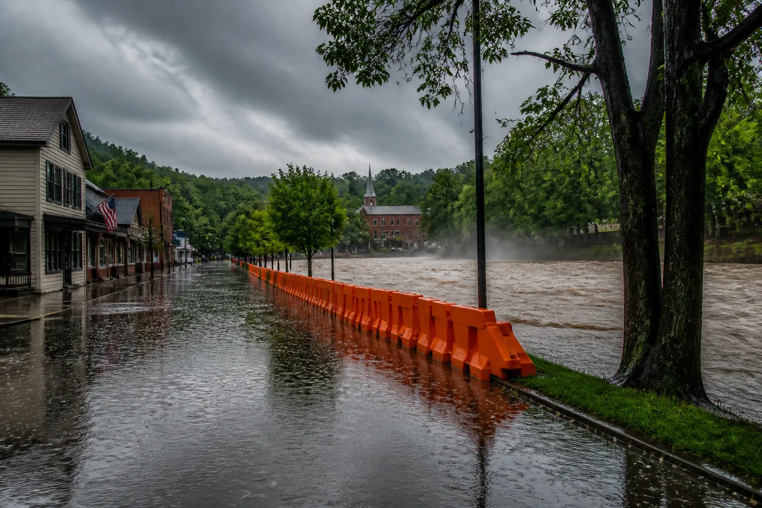
The impact of the flooding is already being felt in several communities. Roads in the affected counties have been closed due to high water, and several neighborhoods have reported minor property damage. The NWS is monitoring river gauges and will issue updates as conditions evolve.
In summary, Indiana is experiencing a significant rainfall event that has triggered severe thunderstorm warnings and flash flood emergencies in multiple counties. The West Fork of the Whitewater River at Alpine is under threat of record flooding, and additional storms from Iowa may intensify the situation. Residents are advised to stay informed through official NWS alerts and local news outlets, and to take precautions against flooding and severe weather.
The NWS will continue to update its warnings and watches as new data becomes available. Local authorities are coordinating with emergency management agencies to ensure public safety and to mitigate the impact of the ongoing weather event.
The NWS notes that the West Fork of the Whitewater River at Alpine, Fayette County, is likely to experience record‑setting flooding. Flash flood warnings are now in effect for Franklin, Ripley, Union and Fayette counties, while a flood watch covers the entire region through Wednesday evening. The warnings are based on rainfall totals of 2 to 5 inches recorded since midnight and the forecast of additional rain.
"The amount of rain that has already fallen is significant for this part of Indiana," said an NWS spokesperson. "We are seeing high water in many areas, and the risk of flooding remains elevated as more storms move through the state.
"The West Fork of the Whitewater River is a known floodplain, and the current rainfall totals are pushing it toward historic levels," the spokesperson added.
The severe thunderstorm warning, which remains in effect until 9:15 p.m. local time, covers the same counties that are under the flash flood emergency. The warning includes the potential for damaging winds, hail and brief tornadoes. Residents in the affected counties are urged to stay indoors, keep away from windows and avoid driving through flooded roads.
The NWS also highlighted that additional storms are expected to track from Iowa later in the week. While the exact path is still uncertain, the forecast models suggest that gusty winds and further rainfall could compound the flooding risk.
Weather forecaster Kevin Robinson, chief meteorologist for WLWT, said the local station’s forecast team is monitoring the situation closely. "We are seeing a pattern of heavy rainfall that is consistent with the NWS outlook," Robinson told WLWT’s weather page. "Our team is working to provide the most accurate information to residents.
"The West Fork of the Whitewater River is a critical area for the community, and we are keeping a close eye on the river levels," he added.
The WLWT weather team has earned a national rating for accuracy, according to WeatheRate, a research company that evaluates forecast performance. The station is the only one in the Cincinnati market to receive the Most Accurate rating each year.
The current weather conditions are part of a broader pattern of intense rainfall across the Midwest. The NWS has issued a flood watch for the entire region through Wednesday evening, indicating that additional flooding could occur as the storms continue to move through Indiana.
County officials in Dearborn, Franklin, Ripley, Union, Wayne and Fayette have issued travel advisories and urged residents to avoid non‑essential travel. Local emergency services are on standby, and the Indiana State Emergency Management Agency has activated its flood response plan.
The forecast for Thursday and Friday remains uncertain, with the NWS advising a "wait and see" approach each day. The weekend is expected to be drier and cooler, which may give residents a brief respite from the current storm surge.
The impact of the flooding is already being felt in several communities. Roads in the affected counties have been closed due to high water, and several neighborhoods have reported minor property damage. The NWS is monitoring river gauges and will issue updates as conditions evolve.
In summary, Indiana is experiencing a significant rainfall event that has triggered severe thunderstorm warnings and flash flood emergencies in multiple counties. The West Fork of the Whitewater River at Alpine is under threat of record flooding, and additional storms from Iowa may intensify the situation. Residents are advised to stay informed through official NWS alerts and local news outlets, and to take precautions against flooding and severe weather.
The NWS will continue to update its warnings and watches as new data becomes available. Local authorities are coordinating with emergency management agencies to ensure public safety and to mitigate the impact of the ongoing weather event.