Blab News
Chelan Hills Fire Rises to 15,000 Acres, Claims Over 100 Buildings in Douglas County
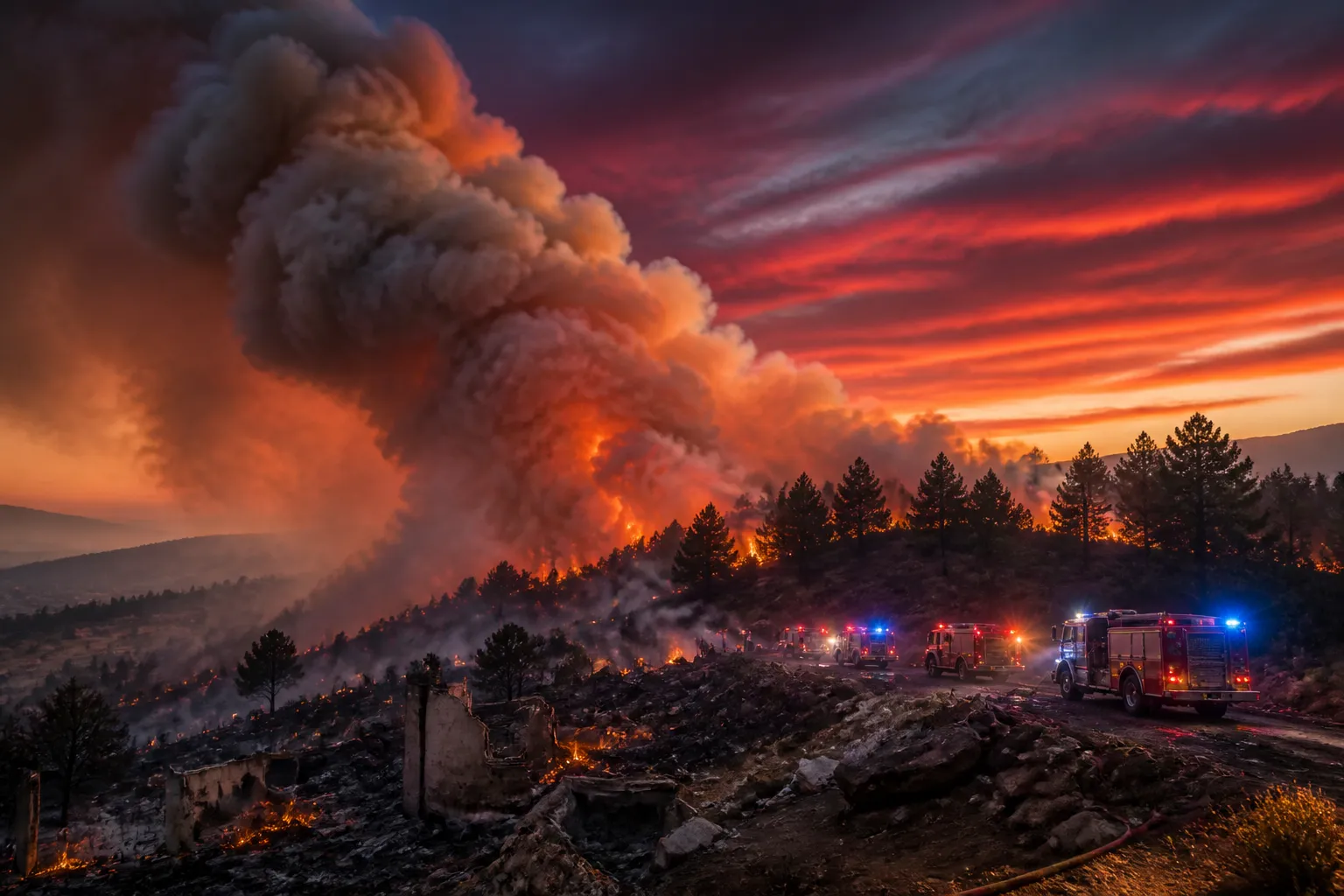
At the stroke of midnight on July 4, a spark along U.S. Highway 97 ignited a wildfire that would soon engulf 15,000 acres in Douglas County.
The blaze, now called the Chelan Hills Fire, has consumed more than 100 structures, according to the Douglas County Sheriff’s Office, and has forced Level 3 evacuation orders across dozens of residential zones east of Chelan, north of the Columbia River.
Firefighters first spotted a small fire moving uphill toward populated areas just after midnight. By 2:30 a.m., the incident command had measured the blaze at roughly 200 acres, burning a mix of grass, timber and ponderosa pine. Officials described the fire as “backing, creeping and running,” with flames 2 to 4 feet high and a southward push along the lower slope.
Ground crews, a bulldozer and hand crews were called in for a second and third alarm, but the steep terrain soon forced crews to rely on helicopters for suppression. By late Saturday afternoon, the fire had ballooned to 5,000 acres and was advancing north into McNeil Canyon. Fire District 5 Chief Tyler Caille told local media that dozens of homes and outbuildings had been lost in that canyon, and that the fire’s steep slopes made ground operations impossible.
The next day, the fire’s perimeter swelled to 10,000 acres. Caille noted that a lull in wind allowed crews to hold the blaze within a defined perimeter, yet the fire remained 0 % contained. He warned that additional damage had appeared in McNeil Canyon, describing the destruction as the most severe he had seen in his 30‑year career.
Satellite imagery from the National Interagency Fire Center confirmed a rapid overnight expansion, with new hot spots appearing in the last 6 to 12 hours and pushing the total area to 15,000 acres. The county’s incident management team plans to release a more detailed update after 6 a.m. on Sunday.
According to the Sheriff’s Office, roughly 75 % of structures within the fire’s footprint have been lost, with the total number of buildings destroyed potentially exceeding 100. Caille called McNeil Canyon “devastated” and said the loss of homes and outbuildings is the most extensive in the county’s history.
Level 3 evacuation orders now cover Box Canyon Road, Heidi Lane, Combine Road, Jerrys Lane, and all residences off McNeil Canyon Road. Level 2 warnings extend to Chelan Hills Acres Road, Park Drive, Jackson Canyon Road, Baty Way, Riverview Road, Canyon View Drive, Rocky Road, Big Ranch Road, Spring Lane, King Bird Lane, Green Lane, Farnham Lane, Spur Lane, and High Corner Road. Residents have been urged to obey orders immediately and to keep abreast of official updates.
The state Department of Transportation shut down U.S. 97 between milepost 232 and 235 south of the Beebe Bridge, redirecting traffic to an alternate route west of the Columbia River.
The Red Cross opened a shelter at the Chelan School of Innovation on 324 E. Johnson Ave. to house evacuees, moving the facility from its previous location to better serve displaced residents.
Fire suppression has included retardant drops by aircraft and the deployment of ground crews where terrain permits. Authorities have asked the public to stay clear of the Sun Cove area to allow safe aircraft access.
The incident remains under the jurisdiction of the Washington State Department of Natural Resources and the National Interagency Fire Center. No containment has yet been achieved, and the fire’s future behavior will hinge on weather and fuel conditions.
At present, there have been no reported casualties, but the scale of structural loss and the rapid expansion underscore the ongoing risk to communities in Douglas County and the surrounding region.
The next official update is expected from the state incident management team after 6 a.m. on Sunday, when more detailed information on containment progress, resource allocation, and potential changes to evacuation orders will be released.